
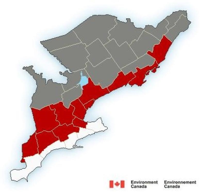
There are warnings of freezing rain from Trenton to Prescott and advisories everywhere else
On Thursday night, there will be ice all over eastern Ontario. There are freezing rain warnings around Kingston, and snow and ice will fall in other places.
From Prescott to Hamilton, the warnings run along Lake Ontario and the St. Lawrence River, from Trenton to Hamilton.
Local forecasts say that freezing rain that starts late at night and stops early in the morning should leave a few millimeters of ice.
The rest of eastern Ontario and Gatineau can expect 5–10 cm of snow, which may be mixed with ice pellets and freezing rain.
Travel advisories for those areas say that the same kind of thing will happen from late Thursday night to early Friday morning.
Deep River should only get snow, and Tweed should only get a little bit less.
There are no alerts for rural western Quebec, but Maniwaki says there will be about 10 cm of snow between now and Friday at noon.
This month, Ottawa hasn’t had more than 4 cm of snow in a single day. This is the fifth straight month that has been warmer than average.
The high temperature of 9.6 °C on February 15 was a new daily record, and the National Capital Commission says that the Rideau Canal Skateway won’t open this week.
Ottawa is expected to have a below-average high of –7 C and a low of –16 C on Friday. The next three days will have highs at or above freezing during the day.