The area around the Tuxedo Golf Course was once a possible site for the University of Manitoba
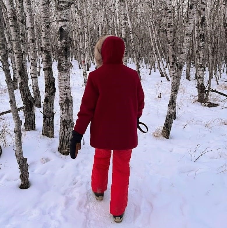
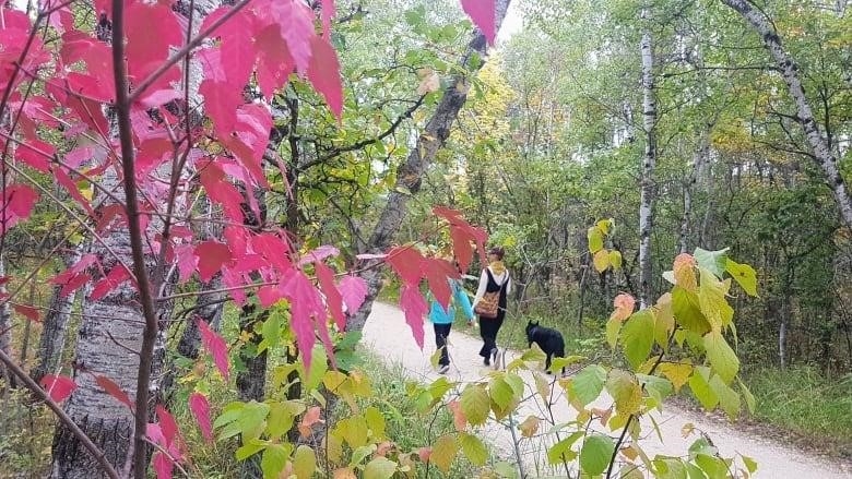
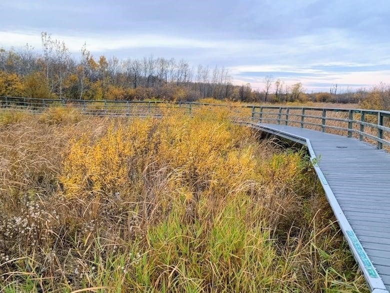
White-tailed deer jump into the thick prairie grass for cover, and owls take off from the branches of aspen and oak trees, many of which were cut down by beavers and are now homes for rabbits. Turtles poke their heads out of the wetlands.
The Assiniboine Forest in Winnipeg can sometimes feel like a scene from a Disney movie.
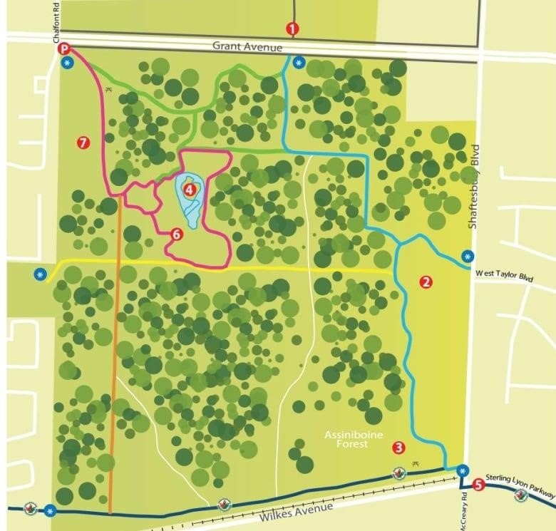
At 285 hectares, it is Canada’s largest urban forest. It is home to a wide range of wildlife, including dozens of songbirds and hundreds of plants, some of which are rare.
But if the stock market crash of 1929 hadn’t happened, it might have turned out to look like any other suburb in the city.
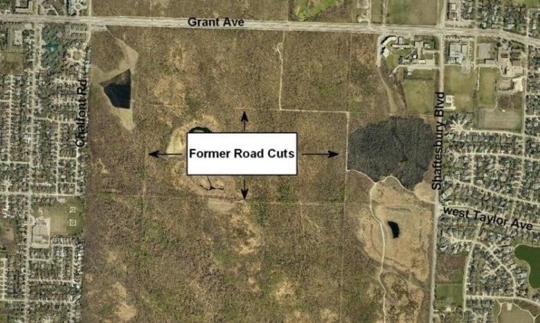
Many of the 18 kilometers of trails, which are bounded by Roblin and Shaftesbury boulevards, Wilkes Avenue, and Chalfont Road, follow the old road cuts from an area that was cleared but never built on.
Evan Duncan, a city councilman for the Charleswood-Tuxedo-Westwood area, said of the road cuts, “I call them scars.”
“It should remind you of what might have been. Some people might say, “Wow, I’d love to live in such a great part of the city,” while others might say, “Wow, did we ever get away with something!”
“You can’t get back what you cut down, destroy, and make room for. I’m pleased with how things turned out.”
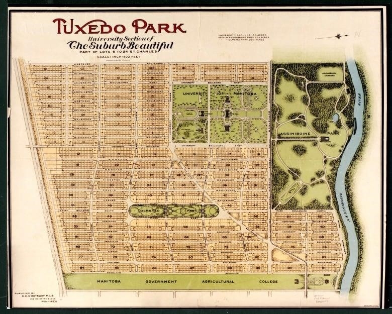
Frederick William Heubach started buying farmland, raw prairie, and forests west of Winnipeg not long after the turn of the 20th century.
The Manitoba Historical Society says that in 1905 and 1906, his Tuxedo Park Company (named after a New York suburb) bought 3,000 acres (1,200 hectares) of land from one family for $540,000.
Heubach hired Rickson Outhet, a landscape architect from Montreal, to plan out his suburb. Frederick Olmsted, who designed Central Park in New York and Mount Royal Park in Montreal, taught Outhet how to build parks.
But by 1910, Heubach had increased his land holdings to 4,500 hectares and replaced Tuxedo Park with the South Winnipeg Company. He needed a new plan, so he hired the sons of Olmsted.
At about the same time, the University of Manitoba had grown too big for its Broadway location in downtown Winnipeg and was looking for a new campus site.
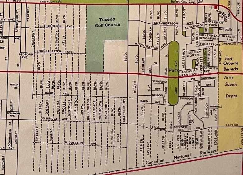
Heubach gave away 61 hectares of land at the corner of Roblin and what he called University Boulevard, which was later renamed Shaftesbury. He did this because he was close to where the province planned to build a new agricultural college.
But the university settled on a bend in the Red River in Fort Garry. They had also thought about putting it in Fraser’s Grove in East Kildonan. When the university moved there in 1913, so did the agricultural college.
The land that was supposed to be used for an agriculture college is now the Asper Jewish Community Campus. The land that Heubach wanted to use for the University of Michigan is now the Tuxedo Golf Course.
Canadian Mennonite University is at the southeast corner of the golf course, so there are also post-secondary schools in the area.
Most of the beautiful Olmsted plan, with its curved streets and wide boulevards, was never fully put into place.
Plans aren’t as good as the forest, says a council member
Olmsted was the original name for Heubach Park. It was supposed to have horse trails, a wading pool for kids, pergolas, flower beds, shrubs, and shade trees. The last two things are true, but nothing else is.
According to the Manitoba Historical Society, investors who might have been interested in Tuxedo were instead drawn to developments closer to the city center.
“No matter what they had proposed, I think it pales in comparison to what we have there now with the Assiniboine Forest and the ability to experience that unique environment right in the city of Winnipeg,” said Duncan.
Despite its setbacks, the Town of Tuxedo was incorporated in 1913, with Heubach as inaugural mayor. The first houses were built in 1915, but progress was again slowed by the First World War.
When the road cuts were made in 1920, people started to pay attention to the area around the forest again.
In this Google satellite view, you can see the path that goes through the middle of the forest and connects West Taylor Boulevard and Eldridge Avenue.
Old maps show that it was supposed to be a continuation of Eldridge, but the Great Depression stopped further development.
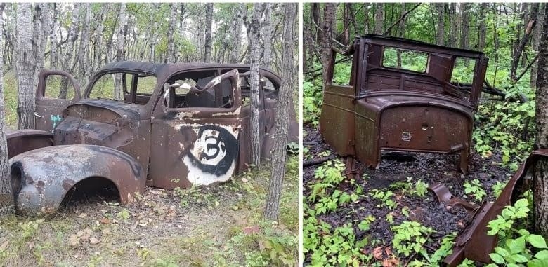
Over the next few decades, people in the area used the forest area for recreation, and a few places were used as small dumps. The wildlife came back and the trees grew.
But the plans didn’t change.
Even after Grant Avenue cut the forest and Heubach Park in half in the 1960s, the planned streets can still be seen on maps.
In 1972, Tuxedo merged with Winnipeg and 12 other suburbs, and the forest was turned into a municipal nature park the following year.
Lobbying for protectio
The Charleswood branch of the Winnipeg Rotary Club has been in charge of the forest for almost 40 years, taking care of it and making improvements.
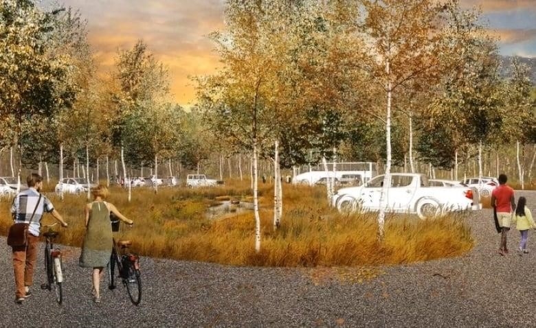
A planning study says that it might add a cross-country ski trail in the winter, make it easier for wheelchair users to get around, and build a second parking lot, among other things.
Mike Dudar of the rotary club’s forest committee says that 180,000 people visit the forest every year, but there is only one small parking lot at the corner of Grant and Chalfont.
That means there are usually a lot of cars on the streets close by.
The new lot would be just inside the forest, near Taylor and Shaftesbury, and would include bioswales, which are channels that can collect and concentrate stormwater runoff.
Change is hard, though, because some people see it as a threat to the forest’s natural state and want to keep it “as their own private domain,” said Dudar.
He said that there is always a chance that another bulldozer will come through the forest.
The Canadian Parks and Wilderness Society is now trying to get the forest certified as a national urban park and permanently protected. “There’s nothing in the city bylaws that protects the forest,” Dudar said.
“If a few council members wanted to build on it, they could, even though there would be a lot of opposition.”
He says that would be a sad loss.
“It would be the same as driving anywhere in the city—there would be nothing,” Dudar said.
“You would never know.”